Friday, May 29, 2015

Utah Overdose Part 2

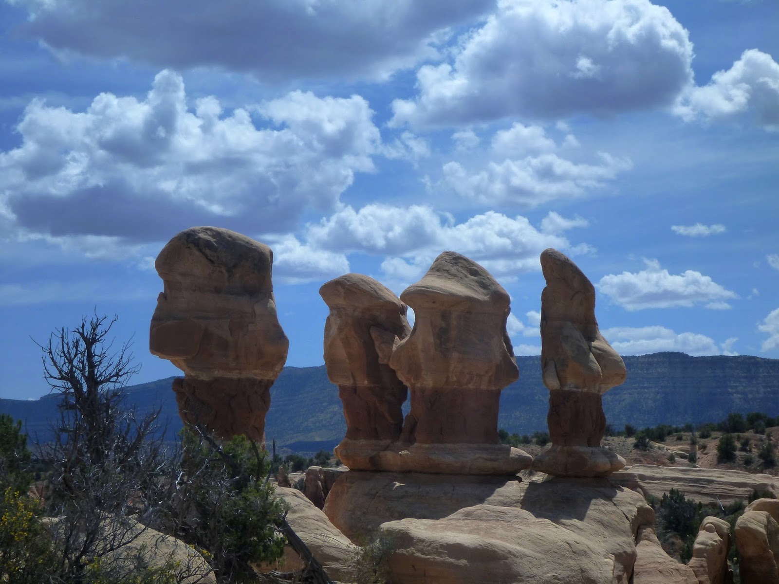
Note:  For Context, see part one of this blog entry, where I detail the first 7 days in southern Utah, including Bryce Canyon, Capitol Reef, and Escalante.  I ended that blog post with a drive back to the Mt Carmel area, ready to start hiking in Parunuweap Canyon the next day.  (for those paying attention, this also meant I visited all five Utah national parks.  I did this in 2013 over a 12 month stretch – this time I did it over the course of 3 weeks!)
 
On Monday morning, I left my motel room in Orderville and headed into Zion National Park.  Shortly inside the park I pulled off the road, just past the Checkerboard Mesa exit.  I held up a sign reading “Mt Carmel Junction,” and stuck out my thumb.  

This was my first time hitchhiking since 2012 on the Great Divide Trail in Canada.  I ended up waiting about 40 minutes, until a lady who was taking some photographs across the road took pity on me as she watched the cars pass me, and ended up taking me back out of Zion and up the highway to Mt. Carmel.  She was on a week-long trip from Michigan, having visited Grand and Bryce Canyons over the weekend, and planning a trip to Antelope Canyon, Monument Valley and on up into Moab after she got done with Zion.  I gave her some advice on the better easy trails in Zion in exchange for the ride.
The East Fork of the Virgin River flows under the highway just a half-mile south of Mt Carmel Junction.  I passed through the bizarrely out-of-place golf course behind the gas station at Mt Carmel, and dropped onto a dirt road paralleling the river, which was more of a creek at this stage.  


The first few miles of Parunuweap were nothing to get excited about.  The canyon is open and shadeless, and ATVs buzz along the road alarmingly often. There’s some scenic white cliffs, but the hiking overall is monotonous.  Maybe a mile below the highway, you skirt below a private ranch house at the Barracks Ranch.  Another mile, and the dirt road finally leaves the canyon, taking the ATVs with it.  


Below the road, I started walking in and next to the creek.  This was a little more pleasant, but the canyon was still relatively open and hot, and filled with cows and their offal.  The cows would continue all the way down as low as Poverty Wash, but in the upper section they are legion.  Unlike the North Fork/Zion Narrows, the East Fork takes its time revealing its beauty.


In the late afternoon, I reached a sandbar across from the mouth of Mineral Gulch.  I dropped my pack here and hiked up Mineral Gulch, through 3 sets of pretty narrows.

In the third and final narrows, I found two relatively fresh deer carcasses.  They had obviously stumbled off the cliffs above and fell down into the slot. I found myself wondering what drama had ensued above to force the deers over the edge of the cliff.  Usually they were so fleet of foot, it was hard to imagine them stumbling accidentally.

The next morning, I headed deeper into the canyon.  Parunuweap remain relatively wide and sunny for the first part of the day, with a riot of green foliage lining either side of the creek.


Mid-morning, I reach the mouth of Rock Canyon.  I explored upstream here, finding it a pretty, green, heavily vegetated drainage much like the main drainage.

However, there was a very short section of slot narrows to remind you why you were there, and what kind of terrain lay downstream.


Back in the main canyon, I left my pack and backtracked a bit from the mouth of Rock Canyon, using the canyon mouth as a landmark to navigate to some petroglyphs marked on the map.  This turned out to be well-worth the detour, with a profusion of detailed petroglyphs etched into a cliff wall.


Below Rock Canyon, Parunuweap started to get interesting.  Huge sandstone walls started to rear up from one side of the creek or the other.  These walls were usually decorated with ferns, desert varnish, and beautiful flowing water beneath.  


In the afternoon, I passed the Desolation Gullies, another side canyon (actually a set of two side canyons) that were lauded by the website I pulled beta from.  I went a short distance up these gullies, but found them wide, sandy and uninteresting.  I pressed further on down the creek.


As the day passed, the scenery progressively got better and better.  Huge rock walls loomed out of the river with greater and greater frequency, at times pushing in from both sides to form narrows.  This was finally starting to look more like the Zion Narrows I knew and loved.


At the end of Day 2, I pulled up to the mouth of Poverty Wash.  This was another recommended side canyon.  I was jolted a little bit to see a pack at the mouth of the canyon, indicating someone was up there ahead of me.  After not seeing a soul for two days, it was a bit of shock to realize I didn’t have this place to myself.  I headed on up Poverty Wash.

Eventually, I ran into the owner of the pack, and it couldn’t have been more of a surprise.  Being a fan of long-distance hiking and Utah, I’ve followed the exploits of Jamal Jamie Green through his acrossutah.com website for a few years.  He’s done a bunch of long-distance, DIY routes through the Utah backcountry, and he’s got a bunch of fun vids on youtube.  Shortly before the trip, I searched him out and sent him a friend request on facebook, so I knew from his posts he was starting another long-distance hike in Utah around the time I was up there.  By some strange coincidence, he was the owner of the pack, and I ran into him a little way up Poverty Wash.  I recognized him, and I think he was a little taken aback to run into someone who knew his name in some obscure drainage out in the Utah backcountry.  We chatted for a few minutes then went our separate ways.  I went further up Poverty Wash, which closed in with some very pretty deep dark narrows. 


Eventually I returned to Parunuweap Canyon and set up camp for a second night.


The last day was the best day of the trip, though it was unfortunately short.  Shortly below Poverty Wash, you reach the so-called “boulder obstacle.”  This is a small falls where you have the option of a sketchy downclimb directly next to the falls (with a swim to exit), or an easier crack climb through a narrow tunnel next to the falls.  I opted for the tunnel.


Below the boulder obstacle is the golden section of Parunuweap known as the Zion Barracks, where huge sandstone walls soar out of either side of the creek.  The scenery here is as good as Zion Narrows, and worth all the effort you put in to get here.


After several turns of the canyon, Fat Man’s Misery canyon spills in from the north.  You can only make your way into this canyon a little bit before it gets technical, but man is it beautiful.


The section of Misery Canyon you can access is wall to wall water, which is surprisingly warm thanks to a hot springs that flows into the canyon right before the exit.  The water temperature means that the canyon is humming with life.  The walls of the canyon were draped with moss and ferns, and literally hundreds of frogs clung to every available surface.


Entering the canyon, the frogs would do kamikaze dives into the water when they saw you coming.  This is always entertaining in a normal canyon, and here it was completely over-the-top as dozens of frogs hit the water at the same time.  


I made my way as far up the canyon as I could before turning around.  Fat Man’s Misery is DEFINITELY on my short list of Zion technical canyons to run through in the future.


Below Fat Man’s Misery, Zion Barracks hit it’s crescendo.  Glowing walls rose from flowing, beautiful water.  This section of canyon was on par with Wall Street in Zion Narrows, a place so beautiful your whole being hums.  


Unfortunately, it was over all too quick.  Just around the corner from the mouth of Fat Man’s Misery, a breach in the canyon walls on the north allows access to the rim.  Although steep and treacherous, this was the route out of the canyon.  At the base of this “trail” I found a plaque honoring John Wesley Powell, who explored the canyon in 1872 and was the one who dubbed it Parunuweap.


The narrows continue below the Powell Plaque, and I followed them for a half-mile, across the official boundary of Zion National Park.


Eventually, the canyon reaches Labyrinth Falls.  This marks the official turnaround point; below the falls the canyon’s been declared off-limits.  Which is a shame, as it looks like the spectacular scenery continues.


Back at the Powell Plaque, the route climbs steeply up to the rim of the canyon.  The first section of the route is the worst, and degenerates into hand-over-feet climbing.  At one point, I got sketched out enough that I shed my pack and tied a piece of webbing to it.  I went up the climb packless, then hauled my pack up after me.

The technical part of the exit doesn’t last long.  On the rim, the grade moderates, and a sketchy trail forms that leads up towards Checkerboard Mesa.  I’d been curious for a long time about hiking in the east end of the park, not down in the canyons but over the slickrock domes and mesas, and it was nice to finally explore and see what this terrain looked like, not from the car but on foot.


That’s not to say it was all fun.  Although the grade wasn’t too bad, there was lots of sand slogging, and very little shade.  The temperatures in April were not too bad, but I couldn’t picture trying to do this hike in summer.  By the time I reach the pass on the west side of Checkerboard Mesa, I was pooped.


From the pass, you follow a canyon down the west side of Checkerboard Mesa.  It’s a nice reprieve from the heat, and has some minor narrows that you bypass.  Mostly, I was happy to zoom through this canyon and hit the road to Springdale and a cold beer.

Following the hike down Parunuweap, I went and stayed with a friend who lives in Hurricane, Utah.  We had met the previous year during a canyoneering class in Escalante, Utah, and a friendship had solidified over a series of technical backpacking/canyoneering trips in the Grand Canyon in the fall and spring.  He very generously agreed to host me overnight so we could go and do a technical canyon together the next day.  
We debated some potential places to go, including back into Zion, and eventually settled on the Silver Reef, an area in the Dixie National Forest just outside of Hurricane, which is very popular with the locals.  It features a number of excellent canyons, none of which require permits and which usually have less people than the canyons in Zion.


Yankee Doodle was the canyon of choice.  This was a short canyon with a very good effort:reward ratio, that is a popular spot  where local guides teach canyoneering classes.  From the road, you walk less than two minutes to the head of the canyon and drop right in in a series of easy rappels.


Because of the recent rains, Yankee Doodle was in full water mode.  Usually there’s only a few swims and much of the water can be avoided, but on our trip every pool was full with icy cold water.

As per usual for canyon country, the scenery was fabulous.


We ended up rappelling a bunch of short drops that maybe could have been downclimbed.  Both of us are relatively experienced canyoneers, so this was interesting to me.  Rappelling is the safer choice, of course.  I think the fact that it was just the two of us helped drive this choice.  With only two people (and both of us were fast and efficient rappellers) the rappel stations didn’t turn into the bottlenecks they are with larger groups.  We could rig the anchor, deploy the rope, rappel down, and pack the rope back up almost as fast as if we had stopped to downclimb - especially as some of these downclimbs would have required hand lines anyway.  And we were much safer than had we downclimbed everything.  Some of these little drops had nasty undercuts or other issues you couldn’t necessarily see from the top.  Anyway, it was an interesting dynamic and seemed to work out well.  We did end up downclimbing some drops later in the canyon.


In less than two hours, we finished the canyon, and after a pretty sketchy climb straight up a slickrock slope, we exited the canyon and were back at the car.  After returning to Hurricane, I hit the road and drove onward.

Near Page, I pulled off the road again.  There is a very nice, short and sweet canyon just outside of Page known as Blue Pools.  I had been through this canyon last year on the return from the canyoneering class in Escalante.  This is a very easy canyon, with only two rappels of consequence.  I stopped here and ran the canyon solo, returning to my car in less than two hours.


And that was it for my southern Utah ramble!  After Blue Pools, I drove straight through back to Phoenix.  It’s been three weeks now since the trip and I’m still flashing back on it.  I can’t wait to get back in that glorious country again!

Thursday, May 28, 2015

Utah Overdose - Part 1

Early in the year, the company I was working for decided to restructure.  While I could have stayed on as a contractor, my income would be far less certain.  So, I revamped my resume and started putting out feelers for something else.  After a series of interviews with different companies, I received an offer that I accepted.  
I managed to finangle a one-week gap between the old job and the new.  I also fully expected the last week on the old job to be relatively lightweight.  So I threw a bunch of camping, hiking, and canyoneering equipment into my car, and headed up to Utah.  My plan was, while I was still technically “on-duty” for the old job, I would hang out in the morning somewhere where I’d have a cell signal – mostly around Escalante.  Once I was done with “work” for the morning, I’d use the afternoon to go exploring.  The Hole-in-the-Rock road promised tons of good short dayhiking opportunities.  Once the final “work week” ended, I’d launch off on a more rigorous backpacking trip over the Boulder Mail Trail and into Death Hollow, and follow that up with a second multi-day trip down Parunuweap Canyon near Zion.  I pulled together the plans for this trip very quickly – it helped that it was southern Utah, as I’m familiar with the area and have a backlog of places there I’ve been wanting to visit, so it was easy to slap together an intinerary of trips with a few days’ notice.
I headed up Sunday night and camped just outside of Jacob’s Lake off a dirt road.  I’ve had this location in mind for awhile as a good spot for a “truck bivy” that’s reachable from the Valley in one post-work evening’s drive, and which puts Kanab, Zion, etc within striking distance the next morning, and it was good to confirm this was do-able.  I will definitely be using this again for weekend “blitz” trips to Zion.
The next morning, I headed down off the Kaibab Plateau and into Kanab.  On the spur of the moment, I decided to try to get a walk-in permit for Coyote Buttes and the Wave.  Even though I was competing for a mid-week (Tuesday) permit, the competition was still amazing – 71 people competing for 10 permit spots! 

 Needless to say, I didn’t get one.  In retrospect I was glad, as I would have had to juggle things a lot to accommodate a successful permit, and wouldn’t have seen some of the stuff I ended up seeing in Escalante.  It’s unfortunate what’s happened to Coyote Buttes.  The area has been publicized to the level of Antelope Canyon, but doesn’t have nearly the same capacity to accommodate the crowds.  I think the only “insider’s trick” there is to stand a better chance of scoring a permit is if you plan to get one for a major holiday.  I’ve decided I may try to get a permit for Thanksgiving Day, and tag the trip along with a backpack down Buckskin Gulch.    
After the Wave permit fiasco, I spent a few hours hunched in my car in the McDonald’s parking lot, leeching their free wifi.  I was able to wrap up my boss’ request and get all my emails out by 12 or so, and then hit the road for Bryce Canyon. 


I’ve been to Bryce several times before, both alone and with my wife.  I’ve hiked the main trails in the Bryce amphitheater (Navajo, Queens Garden, Peekaboo) several times now.  So, this time around I decided to hike down on the Fairyland loop.  This is a less well-known and certainly less well-visited trail in Bryce. 


 It travels through a region just north of the main amphitheater, so not quite as spectacular as the main trails.  But “less spectacular” at Bryce Canyon is a relative measurement. 

 This was still an absolutely amazing hike, with scenery to beat any trail in North America, and lots of solitude and quiet to boot.  If you’ve never been to Bryce before, focus on the main trails, but this is a great way to spend an extra day in the park.  The total loop was around 8 miles and took me maybe 4 hours.  


After the hike, I snagged a campsite in the park.  I had originally thought to camp near Escalante, but there was good cell service in the park, so I could check email in the morning easily, and I had the chance for another one of those unbeatable Bryce Canyon sunrises ☺


After sunrise, I headed down into Escalante.  I had breakfast at the Escalante Outfitters, which also allowed me to get a password for their wifi.  The food here was excellent, and I’d go back for pizza several times in the days ahead.  I spent a couple hours on wifi working.  My soon-to-be-former boss let me know that there was very little else I’d need to do for him this week.  I’d want to check in on email, but otherwise I was essentially done with my old job.


From Escalante, I headed down into the Escalante River canyon and did the hike up Calf Creek.  This is a touristy hike that you’ll share with many others, but the destination is definitely worth putting up with the crowds.


After Calf Creek, I headed back towards Escalante, and took a drive down the Hole-in-the-Rock road.  On the drive in, I discovered that the cell signal from Escalante extended out for the first few miles of the road, and there was excellent camping off to the right only a half mile in.  I’d camp here the next few days, which allowed me to check in with work and my wife.

I drove in past the campsites to the Harris Wash area.  I dropped in to Harris Wash and headed up to check out Zebra Slot. 

 This was one of the most photogenic slots I’ve ever seen – maybe even moreso than Antelope Canyon.  


The slot is incredibly short - the pretty section is probably less than 50 yards total – but so iconic that it was worth the effort to see at least once.  I passed a ton of people on the way in, but the crowds fortunately abated long enough for me to experience the slot to myself.


After Zebra, I headed further down Harris Wash to visit Tunnel Slot.  I’m on the fence if this was worth the effort, as it’s a lot of sandy trudging for very little payoff.  The “tunnel” itself was interesting, but even shorter than Zebra and not nearly as photogenic.  Still, a day in the canyons is better than any day in the office.

The next morning, I headed further down the Hole in the Rock road.  The goal today was to visit another set of very popular, touristy non-technical canyons, this time in the Dry Fork of Coyote Gulch.  The destination was Peekaboo and Spooky Gulch.  I was the first car at the trailhead, and quickly dropped down to the floor of the dry fork.  I made a miscalculation here.  Where the trail meets the canyon floor, you can jump right into Peekaboo Gulch, or take a left and walk up the Dry Fork, which has some narrows of its own.  I generally enjoy visiting places like this by myself, and it starts to grate on me if I have to share it with a bunch of people, so I was psyched to be the first person there.  I chose to turn left and head up the Dry Fork, spending 15 minutes walking up and down the beautiful narrows.


Unfortunately, those 15 minutes allowed enough time for a group of older ladies to catch up with me.  By the time I was back at the entrance to Peekaboo, the group was hot on my heels.  I know it’s unintentional, but I can’t help but bristle when a large group fails to give a bit of breathing space to a solo hiker, and feels the need to fill the silence of the wilderness with chatter about inane topics.  When I saw the group coming, I quickly climbed up into the entrance to Peekaboo, trying to put some space between me and them.  Rather than give me a few minutes to get ahead of them and enjoy the canyon on my own, though, the ladies followed in right behind me, filling the echoing slot with noise.  To make matters worse, they had trouble getting in, and starting hollering “HELLLLOOOOO” at me to turn around and help them up.  Had they been a bit more polite about it, I might have turned around to help, but instead I just headed up the canyon, annoyed.  It was a shame too as Peekaboo Gulch was insanely scenic, with four natural bridges and beautiful wavy narrows, again reminiscent of Antelope, but I was too busy grousing to myself to really enjoy it.    The canyon was again short, and all too quickly I was climbing out of the canyon and over the ridge to Spooky Gulch.  


At Spooky Gulch, I ran into the ladies again.  At this point I was thoroughly frazzled.  When asked why I hadn’t turned around for them, I replied simply “No offense, but I’m not a tour guide,” and then went to sit on a hill waiting for them to get out of Spooky.  After a few minutes, they left and silence returned.  I know I shouldn’t get as annoyed as I do – they weren’t doing it on purpose, they just come into the wilderness for different reasons and with different expectations about space and stillness.   But it still got under my skin.  After a few minutes sitting and enjoying the quiet, I got up and headed up Spooky Gulch.  This is a lovely canyon with very tight narrows.  It’s also unfortunately a little short.  I went up to a point where it got too narrow to be enjoyable, then turned around and headed out again.


Back in the Dry Fork of Coyote Gulch, I turned and headed downstream, through another short set of narrows.  I was attempting to find Brimstone Gulch, but somehow blew past it and ended up in a wide canyon with huge sand dunes. I turned around and headed back.  This time I was keeping my eyes peeled for Brimstone, but still somehow managed to miss the mouth of this side canyon.  However, I had the main canyon all to myself, and was able to mentally reset from my encounter and take on a more cheerful disposition. By the time I got back to the mouth of Peekaboo Gulch, I was feeling fine.  Which was good, as the canyon was now swarming with groups of tourists.  There was a brief lull that allowed me to head up Peekaboo to get a look at the canyon from a better frame of mind.  


On the drive back up Hole-in-the-Rock, I stopped off at Devil’s Garden.  This is a lovely little area with hoodoos and arches.  Having spent lots of time in the previous weeks at Bryce and Arches National Parks, this area was a little underwhelming in comparison, but nice enough for a short visit and good to check off the list.  I didn’t linger long, and quickly headed back into Escalante for a late lunch/early dinner.


After pizza at the Escalante Outfitters, I drove into the Escalante River canyon.  My intended destination for a final hike of the day was upper Calf Creek Falls.  However, I got only a short distance down the trail before turning around.  Unlike lower Calf Creek, the upper version requires serious elevation change, and my feet had been chewed up by an unfortunate decision to wear 5.10 shoes to hike Zebra Slot (a writeup I read had made it sound like the slot could be filled with water).    The harder hike combined with the fact that the upper falls are the less spectacular of the two made me decide to take it easy and try to heal my feet  for the days ahead.  I headed back to camp along the HITR road.

With the previous day’s experiences in mind, I wanted to find a canyon that had extensive narrows, not just a little blip of awesomeness.  I also hoped to find a hike that was not overwhelmed with tourists. At the same time, the canyon needed to be non-technical so that I could safely run it on my own.  A friend of mine texted me to recommend Red Breaks Canyon, so on Thursday morning I headed back to Harris Wash to check it out.  


Red Breaks Canyon turned out to be an ideal recommendation, perfectly fitting my criteria.  It features miles of tight, scenic narrows, especially in the Big West Fork which has a deep, dark primeval slot that goes on and on.  

Because there’s a decent amount of stemming and chimneying needed to get around chokestones, the tourists stay away, so I had the canyon to myself, and the scrambling itself was a lot of fun. 

 I went all the way up the main fork, then scrambled around a 50’ dryfall to explore the Big West Fork.  There were about a dozen chokestones that required climbing, though only one in the BWF that was relatively “spicy.”   


My original intention was to go all the way up and out of the Big West Fork and then routefind over to a geological feature called the Volcano.  On the internet, this is referred to as the Ashtray of the Universe or the Cosmic Ashtray.  I found the name charming and wanted to check it out.  However, the narrows at the top of the BWF got so tight that I couldn’t comfortably get up them, without some very high stemming.  So I eventually turned back around and backtracked down the BWF to a point I could climb out to the rim and walk the rim of the canyon back to Harris Wash.  Overall, a great day, and a good transition from the easier, more touristy canyons to some more isolated and wild stuff.


On Friday, my original plan was that after finishing up any work I had for the day, I would pack up and head out on the Boulder Mail Trail for a three day hike down Death Hollow.  Unfortunately, a storm that had been in the predictions all week finally solidified, and Saturday and Sunday were forecasted for serious rain.  Heading down a set of multi-day narrows seemed ill-advised.  I played around with several ideas for alternatives.  I could stay in Escalante, but the roads were likely to get muddy and useless.  I could head towards Bryce, but I’d been there.  I could go to Zion, but the most interesting part (the canyons) would be closed up.  After weighing the options, I settled on the notion of going to Capitol Reef National Park.  I’d been there once before with my wife, but it had been a too-brief tease, and I had wanted to spend more time exploring.  More importantly, the developed area of Capitol Reef around Fruita had plenty of overland hikes to visit the slickrock domes of the Waterpocket Fold, so there was plenty of safe hiking to be had in a rain storm.  Capitol Reef it was.


Because Friday was still sunny and dry, I decided to head to Capitol Reef the fun way, taking the Burr trail out past the Wolverine Loop road and up over the Waterpocket Fold.  The view down the switchbacks at the top of the fold was epic.

And driving up the Bullfrog-Notom road was fun too.  


Finally, I hit the developed section of the park.  I drove around a bit taking pictures.


Along the way, I stumbled across a herd of deer, and a flock of turkeys.


Arriving in Fruita, I briefly contemplated the campground, but the idea of hunkering down inside a tent for hours in rain wasn’t too appealing.  I had my hammock, which is a lot more breezy and comfortable in bad weather, but there were no campsites left with good hammocking trees.  And to camp outside the park was risking getting mired down in mud.  So I decided to take it easy and snag a hotel room in Torrey.  


After booking in, I returned to the park to squeeze in one narrows hike before the rain came.  When my wife and I visited, we hiked a brief way down Grand Wash, but turned around before the narrows due to a lack of time.  This time, I hiked in to visit the narrows.  The name was a little misleading, as there was no true slot to be found here.  Instead, you’ve got a 15-20 foot wide canyon, with soaring 500-1000 foot rock walls rising straight up from both sides of the wash.  
It may not be a slot canyon, but it doesn’t lack for scenery.  It reminded me quite a bit of the upper parts of Bell and Little Wild Horse Canyons (in fact, the whole San Rafael Swell reminded me of the Waterpocket Fold in general).  


The next day, I headed back into the park. The destination for the day was the Navajo Knobs trail.  This trail climbs the huge cliffs to the south of the Fremont River.   First it passes Hickman Bridge.


Then the trail makes its way gradually up the cliffs.  The views back to Pectol’s Pyramid are stupendous.


About halfway through the hike, you arrive at the Rim Overlook.  This looks down at the Fremont River and the Fruita historic district.  The domes and expanses of the Waterpocket Fold lay before you.  


From the Rim Overlook, the trail continues up and up.  It winds in and out of side drainages, continuing gradually up the whole way.


The clouds rolled in and filled the world below with mist.  The overlook of the Castle (the big red rocks that loom over the visitor center) was inspiring in the mist.


I turned around maybe a half-mile before the Knobs.  The weather had gotten progressively worse, and the views slowly disappeared, so there wasn’t much purpose getting to the overlook at the end, other than saying I’d done it.  I turned back and headed down.  When I got closer to the Rim Overlook again, the weather cleared, and I had nice views all the way back down.


The next day dawned relatively clear.  Although it had rained the previous day, it hadn’t ever come down hard, and none of the dry washes were running.  While there was still a possibility of rain at mid-day, it seemed like this wasn’t destined to be a huge storm, so I thought I could chance a canyon hike early in the day.  The book sources I had read rated Navajo Knobs and Spring Canyon as the two best hikes in the park, and having done one the day before, I wanted to see the other.  So I found myself fording the cold and swift Fremont River to start the day.


Spring Canyon didn’t disappoint.  Like Cathedral Gorge and Grand Wash, it doesn’t form a proper slot, but its got miles and miles of "narrows," akin to the Zion Narrows, with huge massifs of rock rising from both sides of the creek.  


Unlike some hikes of this kind, the floor of Spring Canyon was not too rocky or sandy, and easy to traverse.  I travelled upstream for several miles, soaking in the scenery, before turning around.


After exiting Spring Canyon, I packed up and left Capitol Reef behind.  Boulder Mountain was covered in snow, so rather than take highway 12 back through Escalante, I headed north along highway 24 through a string of small Mormon towns.  It was Sunday, and the parking lots of all the churches were packed.  The drive was scenic and easy, and before too long I arrived in Mt Carmel Junction and booked into a hotel.  I’d start down Parunuweap Canyon the next day.  See the blog part 2 for Parunuweap Canyon and the last few days of the trip.