In late spring 2012, I was doing some work for a long-standing client in Saskatchewan. Normally, I'd fly through Denver, but recently WestJet had started offering some routes through Calgary. As I passed through the Calgary airport, I passed a window display showing a photo of the Canadian Rockies. This lit a fire in my belly. I'd been casting about looking for a big trip idea for 2012, and wanting to top 2011's Wind River excursion. Having bought the ticket to Saskatchewan, I realized a trip to Calgary was not unaffordable.
Within a week, I was juggling multiple guidebooks from Amazon, piecing together a route through the heart of Banff and other mountain parks. As quickly as I could I put in for a permit, and was approved. Only after getting the permit did I pluck a GDT guidebook off my shelf (bought long ago, when the thruhiking bug had bit me), only to realize I had re-duplicated the route of the GDT. It was a spectacular route, piecing together 170 km of trail through the heart of Mt Assiniboine, Banff and Kootenay.
It required juggling all sorts of logistics. I'd need to use a combination of shuttle bus, taxi, and hitchhiking to get to and from the trailhead. I'd need to arrange airline tickets and hotel rooms for before and after. I'd need to pick up supplies in Canmore that I couldn't fly with. 10 days of food needed to be bought and packed. It was the most logistically difficult trip I'd planned since my thruhike, but the logistics came together surprisingly easily, and in August I was off to Canada.
The taxi dropped me at a remote trailhead on the edge of Banff. This was fully committing in a way I hadn't experienced in some time. Most trips I took were loops, meaning I could and sometimes did cut them short rather than completing the full loop. That option was not available to me now. I had no car to bail out to, and even if I did, I'd have to wait until my plane ticket out anyway. Bailing was not an option, so here I was, a foreigner in BIG wilderness, with nothing but 10 days of backpacking stretching in front of me.


(I wouldn't actually encounter a bear on this trip, a fact which brought relief along with a small tinge of disappointment. I would, however, hear wolves howling across two separate lakes).

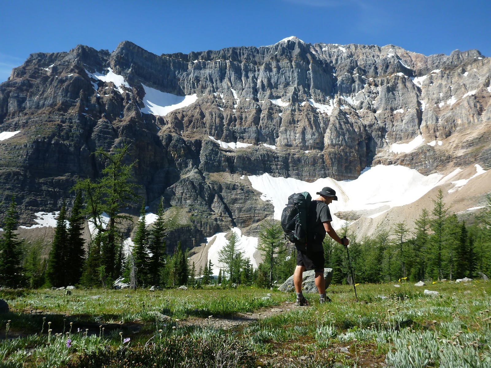
The next day, the trail climbed up into the high country for the first time, climbing over Wonder Pass to enter Mt Assiniboine Provincial Park.


I ended up spending two nights in the park. The beautiful lakes, summits, and scenery were too good to rush through. I climbed Nub Peak on the layover day, which afforded even better views of the park scenery.


Eventually, it was time to leave the idyllic area around Mt Assiniboine, and start to really grind out the miles. I headed north, back into Banff National Park, climbing up over Citadel Pass and to Howard Douglas Lake in a rainstorm. This would be the only inclement weather of the trip.


I passed near a ski area the next morning, which afforded me the opportunity to detour down to a little restaurant for the first fresh food in five days, and a cell phone call to my girlfriend (now wife). From the ski area, I continued on over Healy Pass, into the heart of Banff National Park.


From Whistling Pass, I descended to Haiduk Lake, where I spotted a bald eagle cruising the currents of air above the lake. From Haiduk, the trail descended along a string of lakes. It was an endless procession of marvelous scenery, and I had been out long enough now to slough off the worst of the harried, stressed thinking that you pick up when you spend too much time in the city. I was "walking with beauty," as the AT thruhikers call it, cruising along without a care in the world, open and free.


Add to that the fact that I was hiking alone, without much to do to fill the long afternoon, and my decision was relatively easy. I ate my dinner at Ball Pass campground so that any food smell wound be minimized, then packed up to cross Ball Pass and descend most of the way to the highway. I set up a stealth camp, cutting the distance for the next day nearly in half.


No comments:
Post a Comment